 Where is Cayo Guillermo?
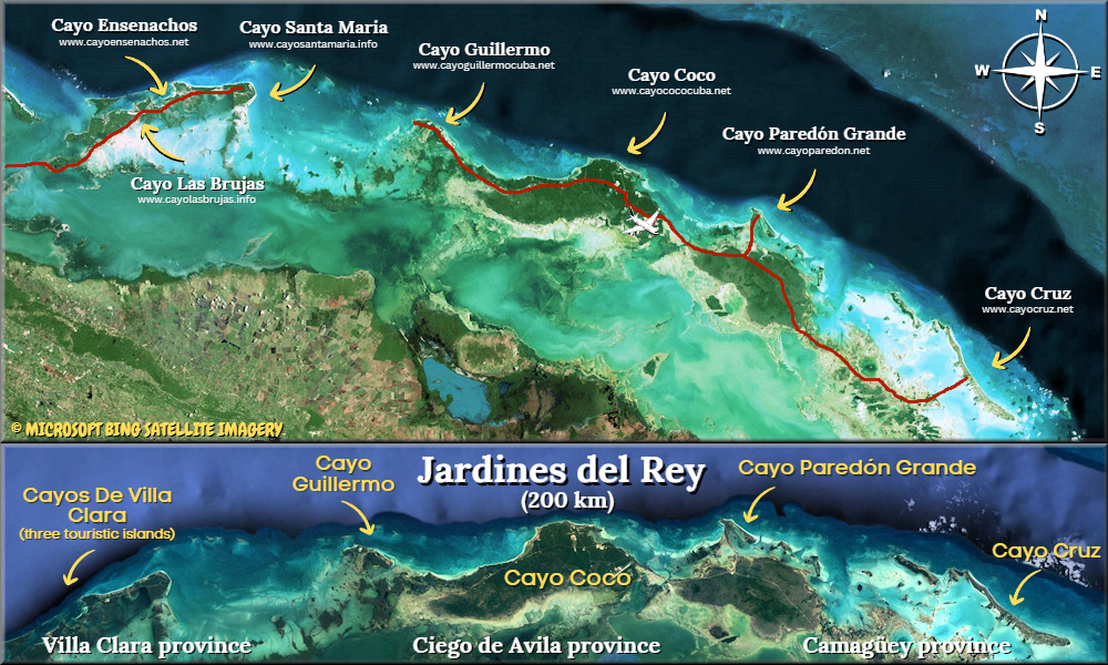
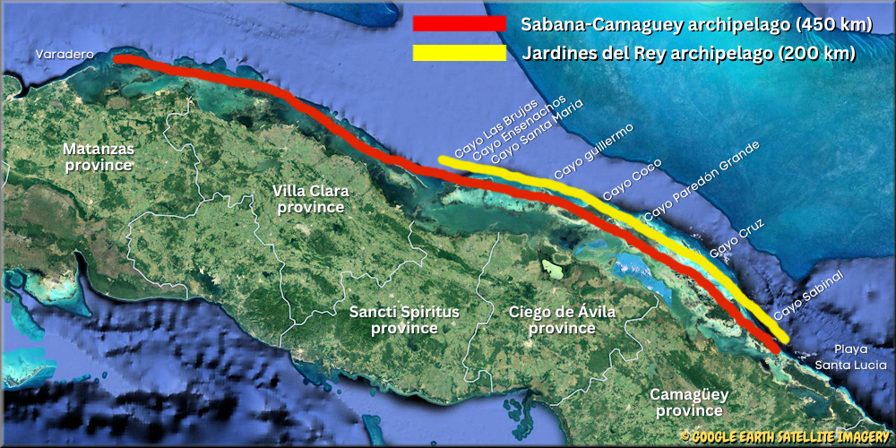
Cayo Guillermo is part of an archipelago consisting of hundreds of coral cays and small islands and called Jardines del Rey (King’s Gardens). It's located off the northern coast of the main island of Cuba (Atlantic Ocean side), in the central province of Ciego de Avila. The Jardines del Rey archipelago is itself part of a larger chain of islands called Sabana-Camaguey which include about 2,500 keys. Also part of the Jardines del Rey is a small sub-archipelago called “Cayos de Villa Clara” which is located west of Cayo Coco/Guillermo, and includes 3 other popular resort islands: Cayo Santa Maria, Cayo Ensenachos and Cayo Las Brujas.
Cayo Guillermo is about 13 km2 (5 sq.mi.), much smaller than its two neighbor to the east, Cayo Coco (370 Km2 / 142 sq.mi) and Cayo Romano (465 km2 / 180 sq.mi). See the interactive map at the bottom of this page.
From an administrative point of view, these cayos are part of the municipality of Moron, but Cayo Guillermo and the other nearby keys are uninhabited (no cities, villages or farms), only tourism infrastructures are found on these resort islands renowned for their spectacular and quiet beaches stretching for miles. The major part of Cayo Guillermo is covered with vegetation, with more than 200 species of birds including a large population of flamingos.
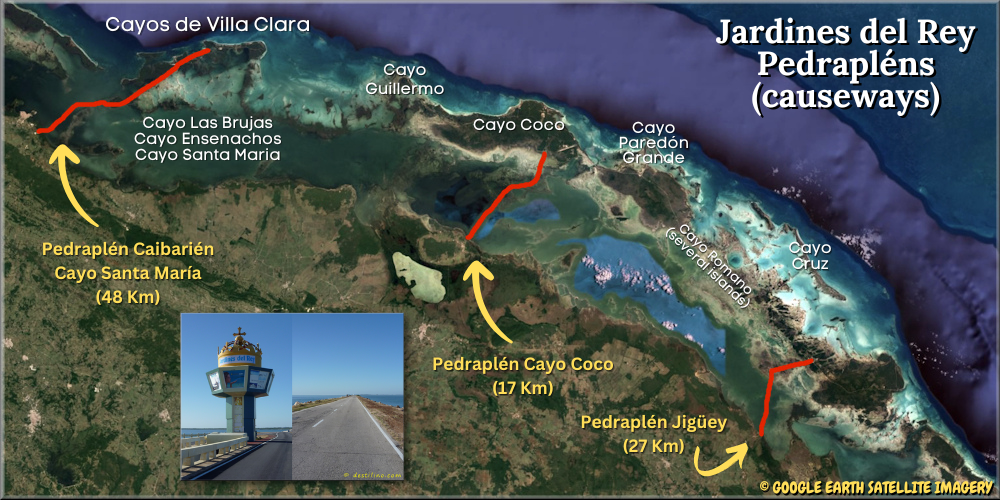
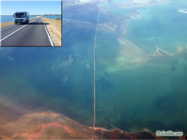
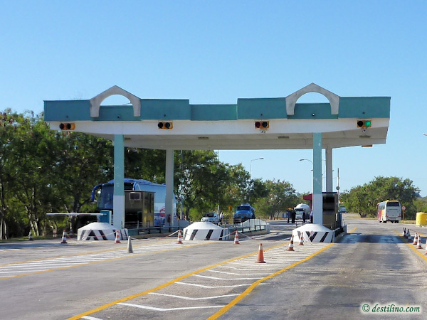
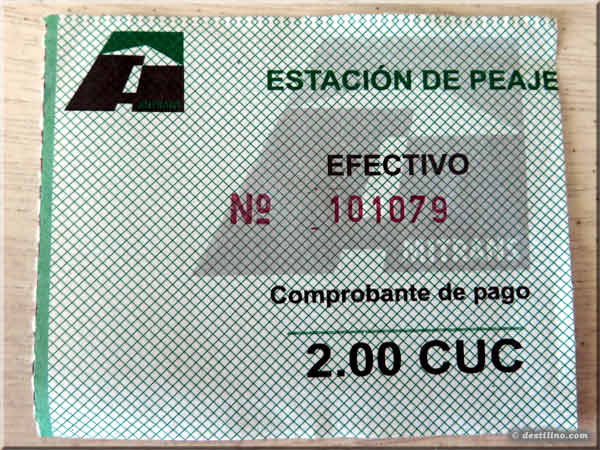
These cayos are connected to the main island of Cuba by a 27-km (17-mi) Pedraplen that runs across the Bahia de Perros (Bay of dogs), with a section of approximately 17 km over the sea. It took 16 months to build and required more than 3 million cubic meters of rocks and stones; the Pedraplen was inaugurated in 1988. A number of openings (bridges) were created in the causeway to restore some water flow and minimize the negative impact of the construction on the local marine life. There’s a toll booth at the entrance of the Causeway (mainland side), toll fee is 2 USD per car per direction to cross the Pedraplen. Another short causeway links Cayo Coco to Cayo Guillermo (to the west), and a series of causeways link Cayo Coco to Cayo Romano, Cayo Paredon Grande and Cayo Cruz (to the East).
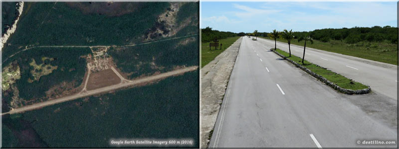
A part of the road that connects Cayo Guillermo and Cayo Coco used to be the runway of the first local airport built on Cayo Coco. The tower of this former airport now serves as an observation tower in the Parque El Baga (nature park). The new international airport, still on Cayo Coco, is larger and it serves the Jardines del Rey archipelago and the province of Ciego de Avila
The Cuban government recently built several apartment buildings (about 4000 rooms) on the coast near the beginning of the causeway. These apartments are for the employees working in the hotels of Cayo Coco/Guillermo, but many of them also live in the closest city, Moron (66 km, about 50 minutes from Cayo Coco), and even in Ciego de Avila, the capital city of the province which is located about 98 km, 1 ½ hour) from Cayo Coco. The province of Ciego de Avila, which was previously joined with the neighboring Camaguey province until 1976, has an area of 6,783 km2 with more than 420,000 inhabitants. Its capital city, Ciego de Avila, was founded in 1840.
Lily & Normand
© cayoguillermocuba.net
© destilino.com